For the past decade, the cities of Charleston and Folly Beach, Town of James Island and Charleston County have collaborated on standards and goals for one corridor — the Folly Road overlay district — that crosses all their jurisdictions and impacts residents in each municipality. An overlay district is one that applies an additional layer of standards to all areas within a defined boundary, regardless of the underlying zoning district.
The staffs and elected officials in the different jurisdictions have set mutual goals, adopted similar zoning ordinances, crafted winning grant proposals and worked to keep their neighbors as well as their own residents informed about development along that corridor.

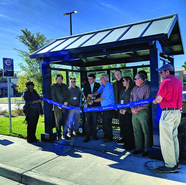
Officials cut the ribbon on a Folly Road bus stop. Folly Road is home to a
multjurisdictional effort to improve transportation and shape development.
Photo: City of Folly Beach.
“If a project is coming to Folly Road that requires a public meeting, notification goes to residents of all four jurisdictions,” said Folly Beach City Administrator Aaron Pope. “That has really been a great cooperative tool.”
That notification has the benefit of involving more residents, but that can also create challenges as residents of the different jurisdictions have different ideas about what they want.
When encouraging resident engagement, said James Island Town Administrator Niki Grimball, “the residents of James Island may not be on the same page as the planning department of the City of Charleston.”
The benefits have become apparent with the creation of bike lanes and a consistent sidewalk path for the whole of the corridor. The effort has also boosted neighborhood preservation and helped shape a commercial core for the road from roughly Maybank Highway to the Atlantic Ocean.
The municipalities and county hired an outside consultant who manages the day-to-day of the overlay district, but each jurisdiction contributes staff and elected officials to the steering committee. The district also has a board for zoning appeals that is a quasi-judicial entity that makes final decisions when development proposals are rejected.
“One great thing is we are starting to see tangible results,” said James Island Planning Director Kristen Crane. “We have two joint applications for grant funding for our big goal of getting the sidewalk all the way down the corridor … People can see it and see the value of it and that is building momentum as it goes.”
In the City of Florence, the overlay districts don’t involve multiple jurisdictions, but they do provide a way to define the characteristics of certain neighborhoods and corridors, and allow in only those uses that would enhance those traits.
“We had adopted the core of downtown as a district, and within that are the smaller arts and cultural, downtown central and historic districts,” said Florence Planning Director Jerry Dudley. “Those were the first overlay districts that defined the downtown area and the layers of targeted revitalization.”

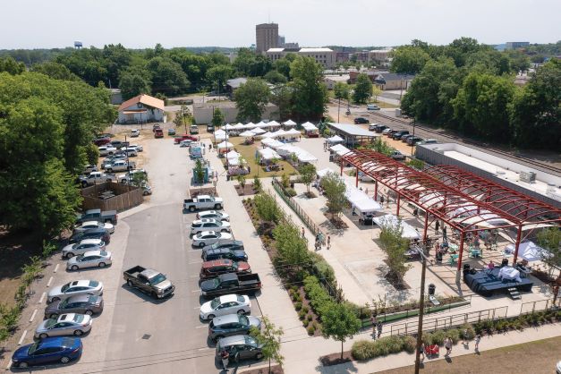
Florence’s City Center Market, which makes use of the frame of an old warehouse structure,
is located in the city’s Food, Artisan and Warehouse District. Photo: City of Florence.
One of the early successes for these character-based districts was the development of Hotel Florence in the heart of the city’s historic downtown. The city has added more overlays in the past 13 years, and now has seven distinct districts.
“Within Florence, there are a lot of different eras of development, and the overlays have allowed us to maintain the character of each one,” said Clint Moore, assistant city manager for planning, research and development.
The overlays can also be used to address other issues.
Florence’s Food, Artisan and Warehouse district, for example, was created to help address the issue of a food desert — that is, an area where a significant population does not have ready access to healthy, affordable food.
Development in the area includes a Save-A-Lot grocery store, which the city helped finance with grants along with the Palmetto Housing Authority, and a city-developed health and wellness campus, including a community center. The city also allocated $3.7 million in tax increment financing funds to create the City Center Market, a city-owned and operated farmers market with rentable commercial kitchen space. The investments are revitalizing a district and bringing in private development as well.
“You don’t see that a lot — a zoning ordinance to combat a food desert,” Dudley said. “But it’s important to understand why you are putting it in place.”
While the results are visible all around the city, Moore said, there is a steep education curve for landowners and some local developers.
“Even though we feel that we have created an ordinance that works for our residents, our local developers have been slow to adopt them,” Moore said. “We’re still trying to educate and work with them, but that’s been one of the largest hurdles.”
For the City of Fountain Inn, which has seen its population double during the past 10 years, the overlay district was intended to guide certain types of development to its Highway 418 corridor north of Interstate 385 and away from its historic Main Street district.
And it has worked so well that the city has amended its original overlay plan to limit the number of similar businesses within a set distance in order to bring a diversity of offerings to the area.

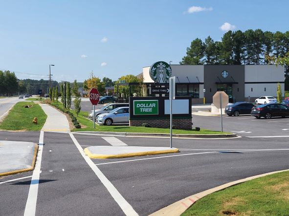
Fountain Inn used an overlay district to guide business development on its
Highway 418 corridor. Photo: City of Fountain Inn.
“Businesses want to be around other like businesses,” said City Administrator Shawn Bell.
That tendency can be valuable — to a point. The city doesn’t want to see that stretch of road simply turn into an interstate exit where drivers pull off for a quick meal at a fast food restaurant then return to the road.
Last year, the city council passed new rules for the district, requiring certain types of businesses, including car washes, dollar stores and nightclubs, to be a set distance apart. The distance requirement limits the potential number of each type of business in the district.
“We were starting to get a lot of inquiries on that corridor that would have made it more of a stop on the interstate, which we don’t want,” Bell said. “We didn’t want three car washes in a row. We wanted some diversity on that corridor … I’m not a huge fan of interfering with the free market, but we have put a lot of effort into that corridor and we didn’t want it to turn into a lot of LULUs [locally undesirable land uses].”
The original overlay is nearly 10 years old, and the changes made late last year were the first major alterations. Trying to keep a consistent set of rules is key to working with businesses that want to locate along the corridor, Bell said.
“The development community likes to know what the rules are upfront. If you have those rules spelled out and they are reasonable, the businesses don’t bat an eye,” he said. “They just don’t want you to change them midstream.”
Overlays require communication, collaboration and patience, but over time they have significant potential to help cities and towns pursue the kinds of development that best fits their community’s needs.
